

Riders – Spode Daddy
Byron
Don’t call me Tad
Uncle Kurt
Uncle Tim
Carl
John
Loop ~ 1166 miles
It was like traveling from island to island through a sea of sage brush .
MONDAY 6/15


Leg : Boise –Homedale-Vale-Crowley- The Narrows- Frenchglen ~ 280 miles.
We rendezvoused at the Jackson’s in Homedale ~ 8AM Monday morning.
Around 8:30 we had everyone gathered up . Byron lead us over Kenney Pass to Vale.

After topping off the tanks we had breakfast at the Starlite Café . Great restaurant !

During breakfast I got caught up from the Micron crew about different co-workers.
Sounds like the company is doing well or thinks they are doing well, hiring and spending.
I have a few shares of stock that might one day be worth as much as the FreeRide
but not a 1190 Adventure.

We traveled US20 to Harper and took the Crowley Road to US 78. The Crowley Road takes you through
Oregon’s Big Empty , for the most part a featureless high desert sage brush range.

Gas and a brew at the The Narrows . It was about a 150 mile gas run from Vale.
Byron wanted to ride The Patrol Road through the refuge . The view of the wetlands was obscured by
willows and other growth. The road had a fresh layer of gravel that made it more squirrelly and dusty.
Not the best experience but we got’er done.

The crew arrived at the Hotel mid afternoon. The mosquitos were restless.

The rooms in the old hotel have been upgraded with window AC units since my last visit, made for a
better nights sleep.

The bugs confined us to the screened porch .
Met a pilot of a SEAT, single engine air tanker, who was stationed in Burns.
He said his aircraft is based on a crop duster.
He was spending his day off in Frenchglen.

The hotel served a big meal of roast , potatoes, salad , broccoli and rolls. Marionberry cobbler with
ice cream for desert.
After dinner John, who runs the Hotel ,gave us a bit of oral history :
Peter French bought the brand “P” from an prospector , Porter , which gave him the rights to
graze a 40 mile stretch from in the valley south of Malheur Lake . Hugh Glen was his business partner ,
providing the financing .
The Swift packing company built the original hotel in 1916 to service visitors to the ranch.
The present structure got indoor plumbing sometime in the 30’s. John said one of his early employees
had worked at the hotel when it still had chambers pots in the rooms, emptying the pots was part of her
cleaning chores.
TUESDAY 6/18


Leg ~ 300 miles
Steen Mnt , Fields Station , Oregon Canyon , McDermitt , Buckskin Canyon , Hinkey Summit ,
Paradise Valley, Winnemucca

Steen Mountain is a large fault block mountain, 9,700 ft summit, that rises ~ 5,000 feet above the
Alvord Desert to it’s east. It has several glacial gorges created a 1-2 million years ago.
It’s lava flows have evidence of the earth's magnetic field flipping , which is one of the reason’s The Pope
says no AC for you !
It’s named after an Army officer that chased the Indians off the mountain .


Carl took a curve a little too fast and found the ditch.


Byron’s photos
")
One of the glacial gorges on the mountain.


The Alvord Desert below. It was a possible route but I was worried it would be too wet to cross.
It had standing water on it.


Fields Station .
Gas stop and refreshments . A couple of the guys had food , most of us had liquids .

Thaddeus , from Denio , wore my helmet for 20-30 minutes until I took it from him.

The plan was to ride Trout Creek Road into McDermitt . Many folks had posted that it was a
‘must do’ ride out of Fields . It took a bit to find it , then it was closed .
Oregon Canyon was the alternate route .


Kurt dropping into Oregon Canyon

Tim at the bottom of Oregon Canyon.
We gassed up in McDermitt . Thad had to fill my bike so I could go piss !
About 15 miles south of McDermitt we caught Buckskin Canyon Road that took us into
the Santa Rosa Mountains .
What a treat ! It was a narrow steep winding road up to Windy Gap.


Great vistas just below Windy Gap.

Thad

Byron


Windy Gap
There is loop that tours through the north end of the basin , but we did not have time this trip.

View of Long Valley

")
North side of Hineky Summit
There are several nice cabins tucked in both sides of the summit .


South side of Hinkey Summit – eye popping views, pure adventure porn !
The Santa Rosa leg may have been the best ride of the trip.

Kids playing in Paradise Valley.

Town House Motel – Good motel, owners live onsite , very helpful .
They even had the AC turned on when we arrived !
There is a laundromat right behind the motel. I washed a load of riding gear for Byron and me.

We had dinner at The Martin Motel Basque Restaurant .
Best meal of the week , probably best meal of any ride !
WEDNESDAY 6/17


John had to head back to Boise from Winnemucca. He was going to ride I-80 to Carlin then the back
roads up through the Bull Run Mnts to HWY 226 .
He had his own adventure :


John’s photos of the Bull Run Mountains

Our ride :
LEG `208 miles
Winnemucca > Soldier Pass ( fail ) > Midas > Tuscarora > Elko

The plan was to ride Soldier Pass , a primitive two-track , north of Winnemucca to the Midas Highway.
The first attempt was to ride the flats north of town. Proved to be too sandy for our skill level on the
big bikes. We backed tracked into town to top off the tanks again then took I-80 to the Golconda exit.
I had a theory that on the east side of the valley we could pick up the two track again and it would be
a gravel mix at the higher elevation. First I couldn’t find the track because I was looking for a gravel
track but it was another sand track ( grown over ) up a sand hill.
Kurt and Thad lead the way and set the high marks , but they decided to turn around. The ride back to the
road was more of struggle because the sand had been plowed up on the ride in. Kurt and Thad said they
both dropped their bikes.
We had to back track again , this time to Golconda and take CR 789 to the Midas Road.

Golconda motorsports shop.
CR789 meandered through some wet lands and ranches . The pavement ended at the Midas Road.
The Midas/Tuscarora Road was as dirt autobahn through the desert floor , super wide some of it with dust control.
Much of it could be ridden 65-75 MPH. It had quite a bit of on coming traffic of rigs that looked like they made
deliveries to the mines.


Road into Midas .

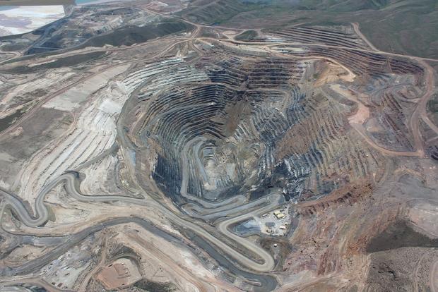
Midas is mining “ghost town” that looks to be populated with vacation homes.
You can see mine shafts and roads on the hill sides around town.

We had hopes to get burgers and drinks at the Café , but it was closed.

Found some shade for snacks and rest.
A UPS delivery truck stopped and talked with us. He said he saw us over the Eden Valley Road when
we were back tracking from Soldier Pass. Told us if we had gone north up Eden Valley to Chimney Rock
Reservoir we could of come down Kelly Creek to the Midas Road. Would have been a nice ride for us ,
dirt not sand.

Tuscarora is another ghost town . No business’s but looks like it might be populated by some desert rats.
Tuscarora is named after a Union battleship in the Civil War, also the name of a Iroquois Tribe.
Wheezer Dell the first MLB player from Nevada was born here .


The restored masonic lodge provided some benches in the shade.

After about 15-20 minutes it became pretty damn obvious there was no Kurt !
Tim and Thad having greater gas range started back tracking to find him.
")
In the meantime Byron discovered the outhouse were actually bathrooms with running water !
We were able to wash up, fill the water bladders and I was able to soak a hand towel &
kerchief to utilize some evaporative cooling !
Thad and Tim were met by a truck that told them Kurt had a flat and was well on his way to getting it repaired .
If they would just wait, they would save their gas and he would would be on his way.
Tim said after Kurt joined them a truck rode their ass all the way back at 75MPH. They didn’t want to eat his dust
so they didn’t let him pass.
We decided to ride Hwy 226 & 225 all the way into Elko instead of ranch roads through the Bull Run Mountains into Carlin.
At the intersection of 226 & 225 we stopped for a beer at Lone Mountain Station. Right after we got our
beers a fellow pulled in on Tenere . He was from Toronto, headed to meet some friends to ride the
WBDR ! First time I’ve seen the Yamaha , it’s big and massive but a nice alternative to a BMW .
As we rolled into ELKO there were all sorts of houses and apartments going up along HWY225 .

The parking lot at the Thunderbird was packed with contractors from “everywhere” working on schools,
roads , housing and mines .
Big mining boom in Elko .
Thursday 6/18


LEG ~ 185 miles
Elko – Ruby Mountains – Deeth – Jarbidge Mountains , Jarbidge
On the way out of town we made a stop at the Elko County Highway office to see if the Charleston
Road was open . It had been closed by some land slides a couple of week back. The lady told us it was open
and we could get through on our bikes.

Entrance to Lamoillie Canyon

Lamoille Canyon is a glacial carved canyon in the Ruby Mountains just south of Elko.
The scenic drive is 12 miles and there 2-3 campsites in the canyon


Byron’s photos
After the Lamoille we needed to back track to Spring Valley for gas , however on the ride in I spotted a Shell
Sign that would save a few miles. The guys ahead of me found it , but of course I missed the turn !


After gassing up and resupplying Gatorade & snacks we rode CR 706 to Star Valley.
It followed the base of the Ruby Mountains along some nice ranches and scenic views .


")
Star Valley had this restored “Progressive Club” – early 20th century socialism on the high desert.


Climbing out of the flats into some more terrain .

Our first bit of shade near Charleston after leaving the Spring Valley Shell


Approaching the Bear Creek Summit

The grass island lake had some deer on it.


Bear Creek Summit North – 8500 ft

Bear Creek Summit South
On the way into Jarbidge I motored down the pass in 1st & 2nd gear sight seeing along the way.
First ride over the pass .
All of sudden a KTM 500 EXC with Giant Loop Bags put a pass on me blipping his throttle as he rode around !
I stopped at the gas pump but the card reader wasn’t working.

Outdoor Inn Jarbidge .


Ron from Evanston , WY said he would sell us 5 gallons of gas if the pump was still down the morning.
He was in Jarbidge with friends and family to spend 4-5 days exploring the back roads.

The kids had to show me their dirt bikes

Ken is the town marshal , we met him on last years trip , said he remembered us .
He told us we would need to leave early , before 9 AM , since they were spraying magnesium chloride
in town and would need 6 hours to dry. So we wouldn’t get to spend any time in town.
He contacted Dennis on the radio to help us at the pump.

Besides the card reader problem , Dennis said the pump was vapor locking in the heat of the day.
He had to prime it and once he got it dispensing we had to fill all the bikes without shutting it off.
I tried to give him some beer money , but he wouldn’t take it.
The café just had one guy checking in for rooms , cleaning and cooking .
We had to wait our turn to order dinner. As we had our dinner a bike rode up and the fellow ordered
an ice cream cone. He fessed up he was our blipper . MasterMarine lives in near Everett and trailers the
bikes to Jarbidge which he has used as a base for a few years.
Says he loves riding the Idaho and Nevada deserts because he can plan routes with a low risk of encountering
locked gates and closed trails .
Friday 6/19


Leg ~ 195 miles
Jarbidge > Rowland > Grasmere> Wichahoney > Grand View > Boise
Byron and I had talked about coffee and piece of pie for breakfast so we could make a quick get away.
However ,Friday morning when we were packing the bikes , the cook was dragging a fire hose around
the side street wetting down the dirt.
Decided to ride out and get an early lunch in Grand View.

We took the Deer Creek Grade out of the canyon. The FS has it marked closed , probably so they don’t
have to maintain it . It had one small slide but otherwise in good condition.
")

It was a fun climb.

Thad

The Deer Creek Road goes through The Diamond A ranch houses. The people were friendly waving to us.
I got to ride in front as we rode across the rangeland to Roland. Saw a elk in velvet and all sorts of pronghorns.


Canyon into Rowland


We stopped in Rowland for breakfast – Bacon Jerky and Gatorade .


Wickahoney was a ranch house and stage stop between Mountain Home and Mountain City.
It was pretty much intact until 10-15 years ago. A fire destroyed it, don’t know if it was a range fire or
arson.
As we were riding down HWY 51 Kurt and I were having a discussion via hand signals
whether to take Shoofly Cutoff or HWY 78 into Grand View .
I thought Shoofly would be shorter but maybe they are the same.
As I turned onto Shoofly I saw Tim look at his front tire but I didn’t stop.
Don't know if it was heat exhaustion, trying to get to the barn or bad case of butt head.


Tim repairing his flat .Highway 51 & Shoofly Cutoff.

We had Mexican food in Grand View.
Good stuff , authentic had to use my Oak Cliff knowledge of the Spanish language to order.
After lunch we decided to take SIMCO Road to the interstate back home.
Appendix -
Kurt's photos
Byron's photos
John's Photo's


")


")


")


")


")


